Note
Go to the end to download the full example code.
Data cleanup#
More often than not, data contained in databases is not entirely consistent, causing errors. It therefore is useful to have some utilities at hand to clean up data. We included some convenience methods to help clean up inconsistent datasets.
We’ll start with the usual imports
import numpy as np

import imod
These imports can be ignored
from imod.schemata import ValidationError
from imod.util import print_if_error
There is a separate example contained in hondsrug that you should look at if you are interested in the model building
tmpdir = imod.util.temporary_directory()

gwf_simulation = imod.data.hondsrug_simulation(tmpdir / "hondsrug_saved")
Update existing model with new data#
Your dear colleague has brought you some new data for the river package, which should be much better than the previous dataset “riv” included in the database.
gwf_model = gwf_simulation["GWF"]
new_riv_ds = imod.data.colleagues_river_data(tmpdir / "hondsrug_saved")
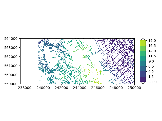
Let’s do a brief visual check if the colleague’s data seems alright:
imod.visualize.plot_map(
    new_riv_ds["stage"].max(dim="layer"), "viridis", np.linspace(-1, 19, 9)
)
(<Figure size 640x480 with 2 Axes>, <Axes: >)
Hmmmm, the western side of the river stage grid seems suspiciously inactive… We have to contact our colleague later. For now, let’s work with what we have and update the model.
old_riv = gwf_model.pop("riv")

gwf_model["new_riv"] = imod.mf6.River(**new_riv_ds)
Lets’s write the simulation with our updated model!
tmp_dir = imod.util.temporary_directory()

# Ignore the "with" statement, it is to succesfully render the Jupyter notebook
# online.
with print_if_error(ValidationError):
    gwf_simulation.write(tmp_dir)
Simulation validation status:
    - GWF model:
        - model options package:
        - new_riv package:
            - stage:
                - not all values comply with criterion: >= bottom_elevation
            - conductance:
                - nodata is not aligned with stage
                - not all values comply with criterion: > 0.0
            - bottom_elevation:
                - nodata is not aligned with stage
            -> You might fix this by calling the package's ``.cleanup()`` method.
Oh no! Our river package has a completely inconsistent dataset. The model validation raises the following issues:
The bottom elevation exceeds stage in some cells
NoData cells are not aligned between stage and conductance
NoData cells are not aligned between stage and bottom_elevation
There are conductance values with value <= 0.0
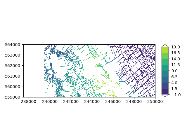
Exercise: Use the function imod.visualize.plot_map to visually inspect
the errors in your colleagues dataset. You can alter the variable name to
inspect different variables.
imod.visualize.plot_map(
    new_riv_ds["stage"].max(dim="layer"), "viridis", np.linspace(-1, 19, 9)
)
C:\buildagent\work\4b9080cbb3354582\imod-python\.pixi\envs\default\Lib\site-packages\dask\array\reductions.py:325: RuntimeWarning: All-NaN slice encountered
  return np.nanmax(x_chunk, axis=axis, keepdims=keepdims)

(<Figure size 640x480 with 2 Axes>, <Axes: >)
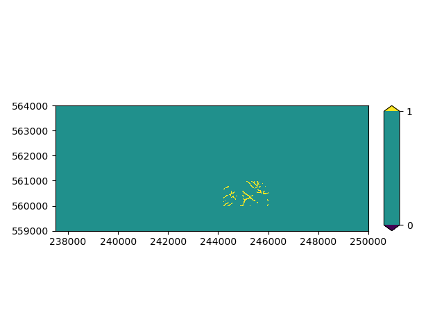
We can also check where stage exceeds river bottom elevation using basic xarray functionality.
stage_above_riv_bot = new_riv_ds["stage"] < new_riv_ds["bottom_elevation"]

imod.visualize.plot_map(stage_above_riv_bot.max(dim="layer"), "viridis", [0, 1])
(<Figure size 640x480 with 2 Axes>, <Axes: >)
So luckily the area affected by this error is only small. Let’s investigate the size of the error here.
diff = new_riv_ds["bottom_elevation"] - new_riv_ds["stage"]

max_diff = diff.max().values

max_diff
array(0.10000038, dtype=float32)
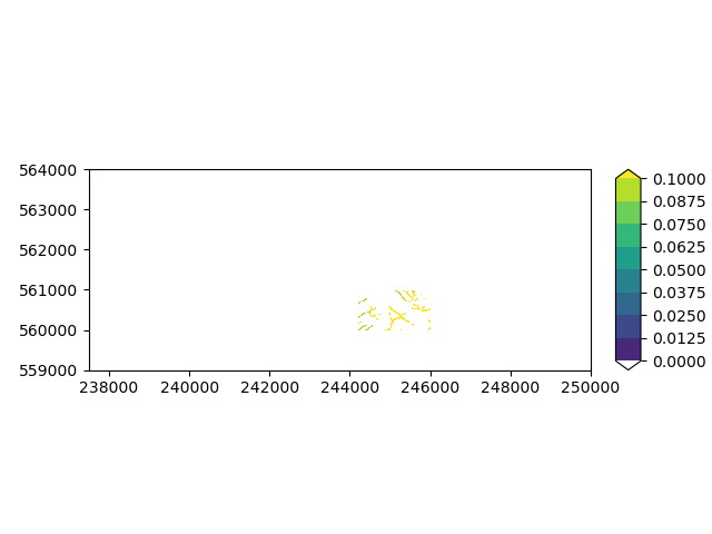
That is a relatively subtle error, which is probably why it slipped your colleague’s attention. Let’s plot the troublesome area:
imod.visualize.plot_map(
    diff.where(stage_above_riv_bot).max(dim="layer"),
    "viridis",
    np.linspace(0, max_diff, 9),
)
(<Figure size 640x480 with 2 Axes>, <Axes: >)
That is only a small area. Plotting these errors can help you analyze the size of problems and communicate with your colleague where there are problems.
The cleanup method#
The data quality seems acceptable for now to carry on modelling, so we can already set up a model for the project. We need to communicate with colleagues later that there are mistakes, so that the errors can be corrected.
iMOD Python has a set of utilities to help you with cleaning erronous data. Note that these cleanup utilities can only fix a limited set of common mistakes, in ways you might not need/like. It therefore is always wise to verify if you think the fixes are correct in this case.
Let’s clean up the problematic river data using the
imod.mf6.River.cleanup() method. Note that this method changes the data
inplace. This means that the package will be updated, without returning a new
copy of the package. This means that we need to copy the dirty dataset first,
before we can do comparisons of the dataset before and after the fix.
dirty_ds = gwf_model["new_riv"].dataset.copy()
We can now clean up the package. To clean up the River package, the method
requires the model discretization, contained in the
imod.mf6.StructuredDiscretization package. In this model, we named
this package “dis”.
dis_pkg = gwf_model["dis"]
gwf_model["new_riv"].cleanup(dis=dis_pkg)

cleaned_ds = gwf_model["new_riv"].dataset
According to the method’s explanation (the method calls
imod.prepare.cleanup_riv()), the bottom elevation should be altered by
the cleanup function.
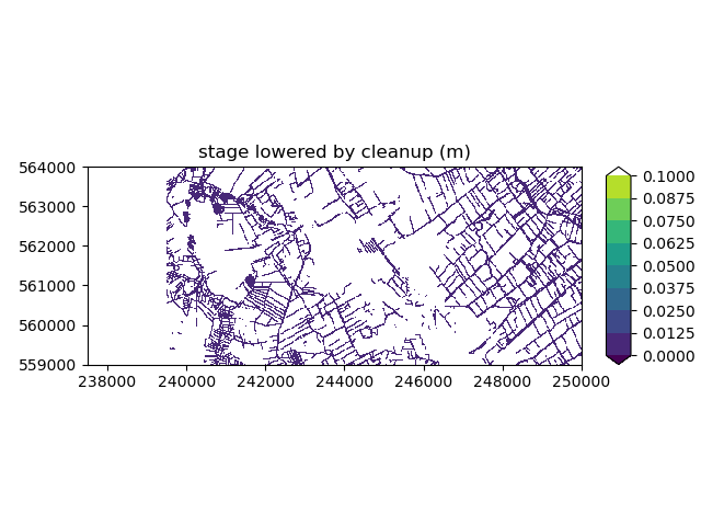
Let’s first see if the stages were altered, we’ll calculate the difference between the original stage and cleaned version.
diff_stage = dirty_ds["stage"] - cleaned_ds["stage"]

fig, ax = imod.visualize.plot_map(
    diff_stage.max(dim="layer"), "viridis", np.linspace(0, max_diff, 9)
)
ax.set_title("stage lowered by cleanup (m)")
Text(0.5, 1.0, 'stage lowered by cleanup (m)')
The stages are indeed not altered.
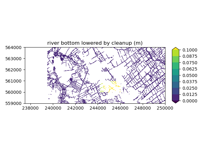
Let’s see if the bottom elevations are lowered, we’ll calculate the difference between the original bottom elevation and cleaned version.
diff_riv_bot = dirty_ds["bottom_elevation"] - cleaned_ds["bottom_elevation"]

fig, ax = imod.visualize.plot_map(
    diff_riv_bot.max(dim="layer"), "viridis", np.linspace(0, max_diff, 9)
)
ax.set_title("river bottom lowered by cleanup (m)")
Text(0.5, 1.0, 'river bottom lowered by cleanup (m)')
You can see the bottom elevation was lowered by the cleanup method. Furthermore the area in the west where no active stages were defined are also deactivated.
We advice to always verify if the data is cleaned in a manner that fits your
use-case. For example, you might need to raise the stages to the river bottom
elevation, instead of lowering the latter to the former like the cleanup
method just did. In such case, you need to manually fix the data.
The cleanup method helps getting your data through the model validation,
but is not guaranteed to be the “best” way to clean up your data!
Writing the cleaned model#
Now that the river package has been cleaned, let’s see if we can write the model.
gwf_simulation.write(tmp_dir)
Great! The model was succesfully written!
Cleaning data without a MODFLOW 6 simulation#
There might be situations where you do not have a MODFLOW 6 simulation or River
package at hand, and you still want to clean up your river grids. In this
case, you can use the imod.prepare.cleanup_riv() function. This function
requires you to to separately provide your grids and returns a dictionary of
grids.
idomain = dis_pkg["idomain"]
bottom = dis_pkg["bottom"]
stage = dirty_ds["stage"]
conductance = dirty_ds["conductance"]
bottom_elevation = dirty_ds["bottom_elevation"]

riv_cleaned_dict = imod.prepare.cleanup_riv(
    idomain, bottom, stage, conductance, bottom_elevation
)

riv_cleaned_dict
{'stage': <xarray.DataArray 'stage' (layer: 13, y: 200, x: 500)> Size: 5MB
dask.array<where, shape=(13, 200, 500), dtype=float32, chunksize=(5, 200, 500), chunktype=numpy.ndarray>
Coordinates:
  * layer    (layer) int32 52B 1 2 3 4 5 6 7 8 9 10 11 12 13
  * y        (y) float64 2kB 5.64e+05 5.64e+05 5.639e+05 ... 5.59e+05 5.59e+05
  * x        (x) float64 4kB 2.375e+05 2.375e+05 2.376e+05 ... 2.5e+05 2.5e+05
    dx       float64 8B 25.0
    dy       float64 8B -25.0, 'conductance': <xarray.DataArray 'conductance' (layer: 13, y: 200, x: 500)> Size: 5MB
dask.array<where, shape=(13, 200, 500), dtype=float32, chunksize=(5, 200, 500), chunktype=numpy.ndarray>
Coordinates:
  * layer    (layer) int32 52B 1 2 3 4 5 6 7 8 9 10 11 12 13
  * y        (y) float64 2kB 5.64e+05 5.64e+05 5.639e+05 ... 5.59e+05 5.59e+05
  * x        (x) float64 4kB 2.375e+05 2.375e+05 2.376e+05 ... 2.5e+05 2.5e+05
    dx       float64 8B 25.0
    dy       float64 8B -25.0, 'bottom_elevation': <xarray.DataArray 'bottom_elevation' (layer: 13, y: 200, x: 500)> Size: 5MB
dask.array<where, shape=(13, 200, 500), dtype=float32, chunksize=(5, 200, 500), chunktype=numpy.ndarray>
Coordinates:
  * layer    (layer) int32 52B 1 2 3 4 5 6 7 8 9 10 11 12 13
  * y        (y) float64 2kB 5.64e+05 5.64e+05 5.639e+05 ... 5.59e+05 5.59e+05
  * x        (x) float64 4kB 2.375e+05 2.375e+05 2.376e+05 ... 2.5e+05 2.5e+05
    dx       float64 8B 25.0
    dy       float64 8B -25.0}
This returns a dictionary which you can use however you want, and furthermore feed to the River package.
riv_pkg = imod.mf6.River(**riv_cleaned_dict)

riv_pkg
Total running time of the script: (0 minutes 5.941 seconds)