Case studies
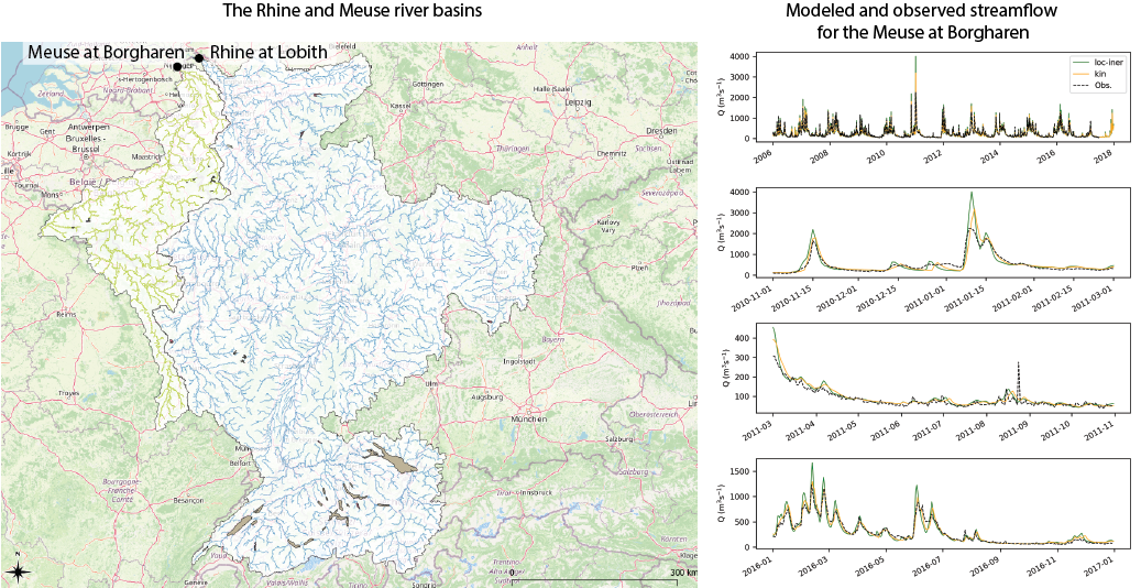
Wflow models for the Meuse and Rhine
Reliable hydrological models for the Rhine and the Meuse river basins are necessary for short-term forecasting of river flows and long-term predictions for strategic water management planning. In collaboration with Rijkswaterstaat, Deltares is developing a new line of models for the Rhine and the Meuse basins. The models will be used for forecasting and to estimate the impact of climate change on water resources and extreme streamflow. In the model development, we aim to improve hydrological predictions by including relevant processes in the model schematization. The modularity of the wflow framework is ideal for this as we can easily evaluate the combination of different vertical and lateral model components. For example, the local inertial routing for river and overland flow enables us to consider retention of water in the floodplains, which is likely to improve extreme streamflow predictions.
Operational flood forecasting in Australia
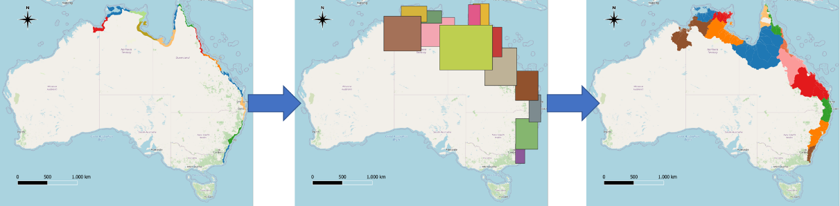
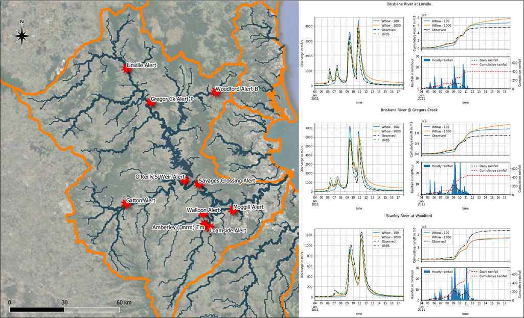
In Australia, there was a need for high-resolution, fast and accurate rainfall-runoff models to provide boundary conditions for a fast and detailed flood inundation model (SFINCS). The domain of the flood model covers the entire North and East Coast of Australia. Although many gauging stations are available to provide real-time information, many rivers are not covered. For these locations, wflow_sbm models are used to provide this real-time information. Additionally, these models are used to provide projections for potential future scenarios. Using the HydroMT library, all wflow_sbm models were automatically built. The high level of flexibility in spatial and temporal resolution, combined with the physics-based nature of the concept, makes Wflow_sbm particularly suitable for ungauged basins. Furthermore, the model is detailed and computationally efficient enough for coupling with the fast flood inundation model SFINCS.
The results of this proof of concept are very promising. Technically, we were able to quickly set up the wflow_sbm models, couple them to the flood inundation models (SFINCS), and run the models operationally under the Delft-FEWS platform. Model validation was conducted for two basins by comparing the results of Wflow_sbm against observations and the results of calibrated URBS models. This validation demonstrated that the uncalibrated Wflow_sbm model results were already quite satisfactory, especially given the complex nature of these basins, which include several small and large reservoirs. We could also show the potential for further calibration by adjusting the KsatHorFrac parameter.
Reference: De Kleermaeker, S., Leijnse, T., Morales, Y., Druery, C., Maguire, S.,
- Developing a real-time data and modelling framework for operational flood inundation forecasting in Australia. In Hydrology & Water Resources Symposium 2022 (HWRS 2022): The Past, the Present, the Future. Engineers Australia. https://search.informit.org/doi/10.3316/informit.916755150845355
Simulating plastic transport in Thailand
For the Pollution Control Board of the Government of Thailand and the World Bank, we supported a material flow analysis of plastics in Thailand using wflow. Plastic pollution is a growing global issue. Plastic waste enters rivers and is transported to the ocean where it persists and threatens the health of the ocean, seas and coasts. The initial movement of plastic waste is in many cases triggered by runoff from (heavy) rainfall and transported by water flow towards small streams and rivers. Therefore there is strong relation to rainfall-runoff processes, which can be modeled using high-resolution rainfall-runoff models.
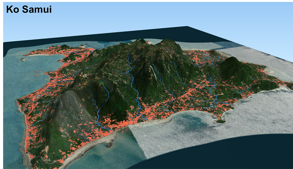
In this study we applied the wflow_sbm model in combination with a fate-and-transport and water quality model (DelWaq) to simulate the movement of plastics through five large river basins and on three island and coastal zones (Krabi, Phuket, and Ko Samui; see screenshot of the model below) in Thailand. Together with our partners Panya Consultants and HII, we were able to identify hotspots of plastic pollution, estimate how much plastic waste would end up in the Gulf of Thailand and recommend priority areas for reducing plastic waste reaching the sea.
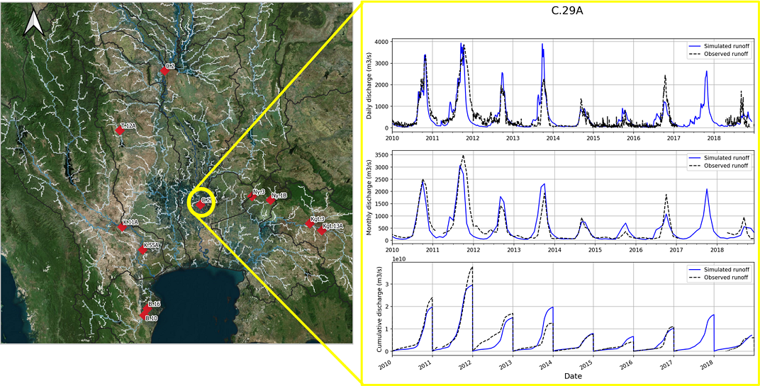
The wflow_sbm models for the five large basins were calibrated. The presence of large dams and reservoirs complicated calibration, but with the input for the dam operation, the model performance for these basins could be largely improved. The figure below shows the calibrated model results for the Chao Phraya, just upstream of Bangkok. The input from the hydrological wflow_sbm model was used as input for the fate and transport model to assess the amount of plastic transported to the ocean.
Link to World Bank report: https://www.worldbank.org/en/country/thailand/publication/plastic-waste-material-flow-analysis-for-thailand